ၵုၼ်ဢေႇသႅၼ်းသျိၼ်ႇ
(လုၵ်ႉတီး Ascension Island ၼႆႈသေ ၶိုၼ်းပိၼ်ႇဝၢႆႇမႃး)
Ascension Island | |||
|---|---|---|---|
| |||
| ၵႂၢမ်းၸိုင်ႈမိူင်း: "God Save the Queen" | |||
 Topographic map of Ascension Island | |||
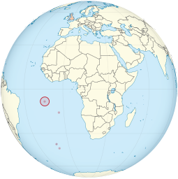
 Location of Ascension Island in the southern Atlantic Ocean | |||
| Sovereign state | United Kingdom | ||
| British settlement | 1815 | ||
| Part of UK Overseas Territory of Saint Helena, Ascension Island and Tristan da Cunha | 12 September 1922 | ||
| Current constitution | 1 September 2009 | ||
| ဝဵင်းငဝ်ႈၸိုင်ႈ လႄႈ largest settlement | Georgetown 7°56′S 14°25′W / 7.933°S 14.417°W | ||
| ၽႃႇသႃႇၸႂ်ႉၼႂ်းလုမ်း | English | ||
| လူင်ပွင်ၸိုင်ႈ | Devolved locally governing dependency under a constitutional monarchy | ||
• Monarch | Elizabeth II | ||
• Governor | Philip Rushbrook | ||
| Sean Burns | |||
| လုမ်းတႅၼ်းၽွင်း | Island Council | ||
| Government of the United Kingdom | |||
• Minister | Tariq Ahmad | ||
| ဢေႇရိယႃႇ | |||
• ႁူမ်ႈ | 88 km2 (34 sq mi) | ||
| ၼႃႈလိၼ်သုင်သုတ်း | 859 မီႇတႃႇ (2,818 ထတ်း) | ||
| ႁူဝ်ၼပ်ႉၵူၼ်း | |||
• သဵၼ်ႈမၢႆႁူဝ်ႁိူၼ်း 2016 | 806[1] | ||
| ငိုၼ်း | Saint Helena pound (£) (SHP) | ||
| ၶၢဝ်းယၢမ်းၼႃႈလိၼ် | UTC±00:00 (GMT) | ||
| ပိူင်ဝၼ်းတီႈ | dd/mm/yyyy | ||
| ပိူင်သၢႆလူတ်ႉ | left | ||
| ၶူတ်ႉတႄႇလီႇၾူင်း | +247 | ||
| UK postcode | ASCN 1ZZ | ||
| ၶူတ်ႉ ISO 3166 | SH-AC | ||
| TLD ဢိၼ်ႇထႃႇၼႅတ်ႉ | .ac | ||
ၽိုၼ်ဢိင်
မႄးထတ်း- ↑ Census 2016 – summary report. St Helena Government (June 2016). Retrieved on 23 January 2017။

