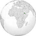
ၾၢႆႇ:Eritrea (Africa orthographic projection).svg

Size of this PNG preview of this SVG file: 550 × 550 ၽိၵ်ႉသႄႇလ်. resolutionsတၢင်ႇဢၼ် : 240 × 240 ၽိၵ်ႉသႄႇလ် | 480 × 480 ၽိၵ်ႉသႄႇလ် | 768 × 768 ၽိၵ်ႉသႄႇလ် | 1,024 × 1,024 ၽိၵ်ႉသႄႇလ် | 2,048 × 2,048 ၽိၵ်ႉသႄႇလ် ။
ၾၢႆႇငဝ်ႈတိုၼ်း (ၾၢႆႇ SVG, ၸိုဝ်ႈ 550 × 550 pixels, သႅၼ်းၾၢႆႇ : 141 KB)
ပိုၼ်းၾၢႆႇ
တဵၵ်းၼိူဝ် ဝၼ်းထိ/ၶၢဝ်းယၢမ်း တႃႇႁၼ်ၾၢႆႇ ၼႂ်းဝၼ်းၼၼ်ႉ
| ဝၼ်းထီႉ/ၶၢဝ်းယၢမ်း | ႁၢင်ႈလဵၵ်ႉ | သႅၼ်းမၼ်း | ၽူႈၸႂ်ႉတိုဝ်း | တၢင်းႁၼ်ထိုင် | |
|---|---|---|---|---|---|
| ယၢမ်းလဵဝ် | 08:55, 9 ဢေႇပရႄႇ 2018 |  | 550 × 550 (141 KB) | Nikki070 | Reverted to version as of 20:28, 16 December 2012 (UTC); unification |
| 19:37, 17 မၢတ်ႉၶျ် 2017 |  | 550 × 550 (185 KB) | Esmu Igors | Colors from the locator map of France don't seem to have enough contrast; I therefore made Africa on the map darker. | |
| 19:34, 17 မၢတ်ႉၶျ် 2017 |  | 550 × 550 (185 KB) | Esmu Igors | Description, at least on the en.wikipedia.org article "Eritrea" has description about Africa dark grey and the rest of the world gray. I didn't see any of this, so changed the colours as were in an analogous map for France. | |
| 08:37, 15 မေႇ 2016 |  | 550 × 550 (186 KB) | Richard0048 | Reverted to version as of 20:52, 14 May 2016 (UTC) | |
| 08:15, 15 မေႇ 2016 |  | 550 × 550 (186 KB) | Richard0048 | Col | |
| 20:52, 14 မေႇ 2016 |  | 550 × 550 (186 KB) | Richard0048 | clearer borders | |
| 20:49, 14 မေႇ 2016 |  | 550 × 550 (186 KB) | Richard0048 | Reverted to version as of 16:51, 13 December 2012 (UTC) | |
| 20:28, 16 တီႇသႅမ်ႇပႃႇ 2012 |  | 550 × 550 (141 KB) | Sémhur | Light grey version ; prominent Congo river removed | |
| 16:51, 13 တီႇသႅမ်ႇပႃႇ 2012 |  | 550 × 550 (186 KB) | Chipmunkdavis | Version with colours that greatly contrast, with South Sudan border and other fixes | |
| 09:34, 13 တီႇသႅမ်ႇပႃႇ 2012 |  | 550 × 550 (142 KB) | Sémhur | That's your pov, not mine, but please do not destroy informations! (south sudan border and few corrections) |
လွင်ႈၸႂ်ႉတိုဝ်း ၾၢႆႇ
ၼႃႈလိၵ်ႈ ၵွင်ႉမႃးၸူးၾၢႆႇၼႆႉ:
လွင်ႈၸႂ်ႉတိုဝ်းၾၢႆႇလူမ်ႈၽႃႉ
Wikis ၸိူဝ်းဢၼ်ၸႂ်ႉဝႆႉ ၾၢႆႇဢၼ်ၼႆႉ:
- ၸႂ်ႉဝႆႉ ami.wikipedia.org
- ၸႂ်ႉဝႆႉ ar.wikipedia.org
- ၸႂ်ႉဝႆႉ arz.wikipedia.org
- ၸႂ်ႉဝႆႉ avk.wikipedia.org
- ၸႂ်ႉဝႆႉ azb.wikipedia.org
- ၸႂ်ႉဝႆႉ az.wiktionary.org
- ၸႂ်ႉဝႆႉ be-tarask.wikipedia.org
- ၸႂ်ႉဝႆႉ bg.wikipedia.org
- ၸႂ်ႉဝႆႉ bh.wikipedia.org
- ၸႂ်ႉဝႆႉ bi.wikipedia.org
- ၸႂ်ႉဝႆႉ ca.wikipedia.org
- ၸႂ်ႉဝႆႉ ceb.wikipedia.org
- ၸႂ်ႉဝႆႉ ckb.wikipedia.org
- ၸႂ်ႉဝႆႉ cs.wikipedia.org
- ၸႂ်ႉဝႆႉ cu.wikipedia.org
- ၸႂ်ႉဝႆႉ da.wikipedia.org
- ၸႂ်ႉဝႆႉ de.wikivoyage.org
- ၸႂ်ႉဝႆႉ din.wikipedia.org
- ၸႂ်ႉဝႆႉ dv.wikipedia.org
- ၸႂ်ႉဝႆႉ el.wikipedia.org
- ၸႂ်ႉဝႆႉ en.wikipedia.org
- ၸႂ်ႉဝႆႉ en.wikinews.org
- ၸႂ်ႉဝႆႉ en.wikivoyage.org
- ၸႂ်ႉဝႆႉ eo.wikipedia.org
- ၸႂ်ႉဝႆႉ es.wikipedia.org
- ၸႂ်ႉဝႆႉ eu.wikipedia.org
- ၸႂ်ႉဝႆႉ fa.wikipedia.org
- ၸႂ်ႉဝႆႉ ff.wikipedia.org
- ၸႂ်ႉဝႆႉ fi.wikipedia.org
- ၸႂ်ႉဝႆႉ fr.wikipedia.org
- ၸႂ်ႉဝႆႉ fr.wikinews.org
- ၸႂ်ႉဝႆႉ gl.wikipedia.org
- ၸႂ်ႉဝႆႉ ha.wikipedia.org
- ၸႂ်ႉဝႆႉ he.wikipedia.org
- ၸႂ်ႉဝႆႉ hr.wikipedia.org
တူၺ်း ၾၢႆႇmore global usage ဢၼ်ၼႆႉ