မူႇၵုၼ် ၼေႃႇၾုၵ်ႉ
(လုၵ်ႉတီး Norfolk Island ၼႆႈသေ ၶိုၼ်းပိၼ်ႇဝၢႆႇမႃး)
မူႇၵုၼ် ၼေႃႇၾုၵ်ႉ | |||
|---|---|---|---|
ၼႃႈလိၼ် ဢေႃႉသထရေးလီးယႃး ဢၼ်မီးၼွၵ်ႈမိူင်း | |||
| Territory of Norfolk Island Teratri a' Norf'k Ailen (Norfuk)[1] | |||
| |||
| ၶေႃႈၶၼ်ပၢၵ်ႇ "Inasmuch"[2] | |||
| ၵႂၢမ်းၸိုင်ႈမိူင်း: "God Save the Queen"[လူဝ်ႇလွင်ႈဢၢင်ႈဢိင်] | |||
| Territorial anthem: "Come Ye Blessed" | |||
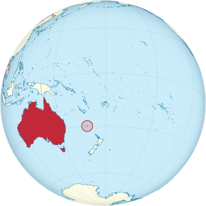
 Location of Norfolk Island | |||
| Sovereign state | Australia | ||
| Separation from Tasmania | 1 November 1856 | ||
| Transfer to Australia | 1 July 1914 | ||
| ဝဵင်းငဝ်ႈၸိုင်ႈ | Kingston 29°02′S 167°57′E / 29.03°S 167.95°E | ||
| Largest city | Burnt Pine | ||
| ၽႃႇသႃႇၸႂ်ႉၼႂ်းလုမ်း | |||
| ၸုမ်းၸၢဝ်းၶိူဝ်း (2016) | |||
| ၵူၼ်းၸႃႇတိ | Norfolk Islander[5] | ||
| လူင်ပွင်ၸိုင်ႈ | Directly administered dependency | ||
• Monarch | Elizabeth II | ||
| David Hurley | |||
| Eric Hutchinson | |||
| ဢေႇရိယႃႇ | |||
• ႁူမ်ႈ | 34.6 km2 (13.4 sq mi) | ||
• ၼမ်ႉ (%) | negligible | ||
| ၼႃႈလိၼ်သုင်သုတ်း | 319 မီႇတႃႇ (1,047 ထတ်း) | ||
| ႁူဝ်ၼပ်ႉၵူၼ်း | |||
• သဵၼ်ႈမၢႆႁူဝ်ႁိူၼ်း 2016 | 1,748 | ||
• လွင်ႈသတ်ႉ | 61.9/km2 (160.3/sq mi) (not ranked) | ||
| HDI (2008) | 0.958 very high | ||
| ငိုၼ်း | Australian dollar (AUD) | ||
| ၶၢဝ်းယၢမ်းၼႃႈလိၼ် | UTC+11:00 (NFT) | ||
• ၶၢဝ်မႆႈ (DST) | UTC+12:00 (NFDT) | ||
| ပိူင်သၢႆလူတ်ႉ | မိုဝ်းသၢႆႉ | ||
| ၶူတ်ႉတႄႇလီႇၾူင်း | +672 | ||
| မၢႆသူင်ႇလိၵ်ႈ | NSW 2899 | ||
| ၶူတ်ႉ ISO 3166 | NF | ||
| TLD ဢိၼ်ႇထႃႇၼႅတ်ႉ | .nf | ||
ၽိုၼ်ဢိင်
မႄးထတ်း- ↑ Buffett, Alice, An Encyclopædia of the Norfolk Island Language, 1999
- ↑ The Legislative Assembly of Norfolk Island. Archived from the original on 18 December 2014။ Retrieved on 18 October 2014။
- ↑ Wayback Machine (25 July 2008). Archived from the original on 25 July 2008။ Retrieved on 6 February 2018။
- ↑ 2016 Census QuickStats Archived 2 October 2017 at the Wayback Machine. – Norfolk Island – Ancestry, top responses
- ↑ Norfolk Island. Central Intelligence Agency (16 October 2012). Archived from the original on 3 July 2015။ Retrieved on 27 October 2012။

