ၾၢႆႇ:Uruguay location map Topographic.png

သႅၼ်းတႃႇတူၺ်းလူင်ႈၼႃႈ: 571 × 599 ၽိၵ်ႉသႄႇလ်. resolutionsတၢင်ႇဢၼ် : 229 × 240 ၽိၵ်ႉသႄႇလ် | 457 × 480 ၽိၵ်ႉသႄႇလ် | 732 × 768 ၽိၵ်ႉသႄႇလ် | 976 × 1,024 ၽိၵ်ႉသႄႇလ် | 2,128 × 2,233 ၽိၵ်ႉသႄႇလ် ။
ၾၢႆႇငဝ်ႈတိုၼ်း (2,128 × 2,233 pixels, တၢင်းလဵၵ်ႉတၢင်းယႂ်ႇ ၾၢႆႇ: 6.19 MB, ယိူင်ႈ MIME: image/png)
ႁူဝ်ႁုပ်ႈ
| ၶေႃႈသပ်းလႅင်း |
Deutsch: Positionskarte von Uruguay
Quadratische Plattkarte, Geographische Begrenzung der Karte:
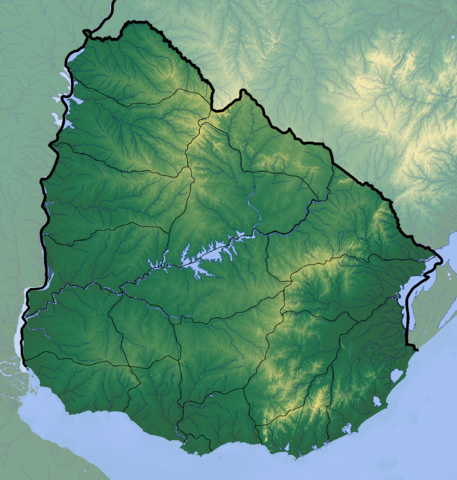
English: Location map of Uruguay
Equirectangular projection, Geographic limits of the map:
|
| ဝၼ်းထီႉ | |
| ငိူၼ်ႈငဝ်ႈတိုၼ်း |
ၵၢၼ်ၶွင်တူဝ်
|
| ၽူႈတႅမ်ႈလိၵ်ႈ | Dr Brains |
ဝ်ႂ
I, the copyright holder of this work, hereby publish it under the following license:

|
ပၼ်ၶႂၢင်ႉ တႃႇတေ ထုတ်ႇဢဝ်၊ ၽႄႈတိုၼ်း လႄႈ/ဢမ်ႇၼၼ် မႄးထတ်း ၼႂ်းလိၵ်ႈၼႆႉ ၸွမ်းၼင်ႇ ၶေႃႈမၼ်ႈၸႂ် GNU Free Documentation License, Version 1.2 ဢမ်ႇၼၼ် ၸိူဝ်းပဵၼ် မၢႆဢွၵ်ႇ ဢၼ်ထုၵ်ႇပိုၼ်ဢွၵ်ႇ ဝၢႆးလင် ၼင်ႇ Free Software Foundation; ဢၼ်ဢမ်ႇမီး လွင်ႈလႅၵ်ႈလၢႆႈ ၵႃႈတီႈ တွၼ်ႈၵၼ်၊ လိၵ်ႈၸိူဝ်းမီးတီႈ ၼႃႈသိုဝ်ႈၽၢႆႈၼႃႈ၊ ၼႃႈသိုဝ်ႈၽၢႆႇလင်။ဢၼ်ပဵၼ် ဝႂ်တႃႇထုတ်ႇဢဝ်ၼႆႉ မၼ်းတေၶဝ်ႈပႃးဝႆႉ ၵႃႈတီႈ တွၼ်ႈၵၼ် ဢၼ်မီးႁူဝ်ၶေႃႈဝႃႈ GNU Free Documentation License ၼၼ်ႉ။ |
If this file is eligible for relicensing, it may also be used under the Creative Commons Attribution-ShareAlike 3.0 license. The relicensing status of this image needs to be manually reviewed by an experienced user. You can help.
|
ပိုၼ်းၾၢႆႇ
တဵၵ်းၼိူဝ် ဝၼ်းထိ/ၶၢဝ်းယၢမ်း တႃႇႁၼ်ၾၢႆႇ ၼႂ်းဝၼ်းၼၼ်ႉ
| ဝၼ်းထီႉ/ၶၢဝ်းယၢမ်း | ႁၢင်ႈလဵၵ်ႉ | သႅၼ်းမၼ်း | ၽူႈၸႂ်ႉတိုဝ်း | တၢင်းႁၼ်ထိုင် | |
|---|---|---|---|---|---|
| ယၢမ်းလဵဝ် | 22:38, 9 ၸုၼ်ႇ 2012 | | 2,128 × 2,233 (6.19 MB) | Dr Brains |
လွင်ႈၸႂ်ႉတိုဝ်း ၾၢႆႇ
2 ၼႃႈလိၵ်ႈ ၵွင်ႉမႃးၸူးၾၢႆႇၼႆႉ:
လွင်ႈၸႂ်ႉတိုဝ်းၾၢႆႇလူမ်ႈၽႃႉ
Wikis ၸိူဝ်းဢၼ်ၸႂ်ႉဝႆႉ ၾၢႆႇဢၼ်ၼႆႉ:
- ၸႂ်ႉဝႆႉ avk.wikipedia.org
- ၸႂ်ႉဝႆႉ azb.wikipedia.org
- ၸႂ်ႉဝႆႉ ca.wikipedia.org
- ၸႂ်ႉဝႆႉ ckb.wikipedia.org
- ၸႂ်ႉဝႆႉ en.wikipedia.org
- ၸႂ်ႉဝႆႉ fa.wikipedia.org
- ၸႂ်ႉဝႆႉ he.wikipedia.org
- ၸႂ်ႉဝႆႉ ja.wikipedia.org
- ၸႂ်ႉဝႆႉ ml.wikipedia.org
- ၸႂ်ႉဝႆႉ pa.wikipedia.org
- ၸႂ်ႉဝႆႉ simple.wikipedia.org
- ၸႂ်ႉဝႆႉ si.wikipedia.org
- ၸႂ်ႉဝႆႉ th.wikipedia.org
- ၸႂ်ႉဝႆႉ uk.wikipedia.org
- ၸႂ်ႉဝႆႉ uz.wikipedia.org